Find Your Daily Voice
Tornado Possible, Flood Watch Issued Across 18 NJ Counties As Thunderstorms Loom
A flood watch is in effect across 18 of New Jersey's counties as thunderstorms with the possibility of a tornado moves in, the National Weather Service said.
The flood watch is in effect until Wednesday evening, Sept. 13, in the following counties, according to the NWS:
Bergen, Burlington, Camden, Essex, Gloucester, Hudson, Hunterdon, Mercer, Middlesex, Monmouth, Morris, Ocean, Passaic, Salem, Somerset, Sussex, Union and Warren.
The NWS said there is a "marginal risk" of an isolated tornado and damaging winds, however, no tornado watch or warning was issued.
A flood watch is in effec…
Large Hail, Tornado Possible In DMV Region As Thunderstorms Return To The Area
Just as the region cleaned up from last week's rash of thunderstorms, a new batch of severe weather is heading toward the region.
Whipping winds approaching 70 mph are possible along with a chance of a tornado, hail, and flash flooding potentially hitting some parts of Washington, DC, Maryland, and Virginia on Monday, Aug. 14, forecasters are advising.
Hot and humid air paired with an approaching warm front will result in thunderstorms later today. Some storms may become severe, with damaging winds, large hail, and an isolated tornado all possible threats. #DCwx #MDwx #VAwx #WVwx pic.tw…
Severe Weather, Flash Floods Snarl Eastern Mass Roads
Good luck trying to get anywhere quickly, eastern and central Massachusetts roads and highways are experiencing serious flooding issues in the wake of heavy thunderstorms.
Flash flood and tornado warnings were put into effect for Suffolk, Norfolk, Worcester, Essex, and Middlesex Counties on Tuesday, August 8, according to the National Weather Service, and communities across the region suffered road flooding and closures.
Between two and three and a half inches of rain fell, according to Mass511, with the area from Bellingham to Brookline experiencing the highest rainfall totals.
Flash flo…
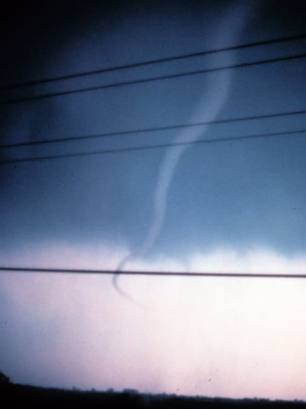
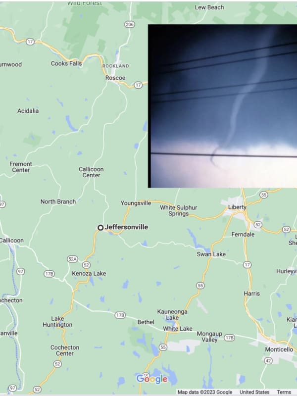
Tornado May Have Touched Down In These PA, NJ Towns
A tornado may have hit Lehigh Valley and Delaware River towns Monday, Aug. 7.
The National Weather Service sent survey teams to evaluate an area west of Milford in New Jersey, as well as areas in eastern Allentown, western Bethlehem, and Hellertown/Coopersburg in Pennsylvania.
A tornado watch has been issued for parts of Delaware, Maryland, New Jersey, New York and Pennsylvania until 11 PM EDT Posted by US National Weather Service Philadelphia/Mount Holly on Monday, August 7, 2023
Storm Photos and comments shared by residents show the severity of the damages the strong storms caused:
…
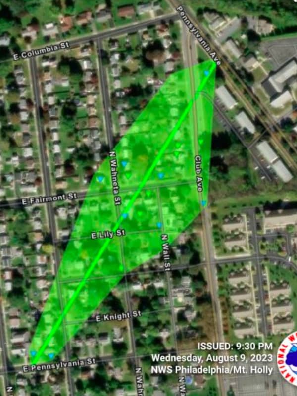
Tornado Touchdown Confirmed In Permberton
Two small tornados touched down in New Jersey and Pennsylvania amid thunderstorms Friday, June 16, the National Weather Service confirmed,
The both were EF-0 twisters: One in Pemberton (Burlington County, NJ), and the other in West Caln Township (Chester County, PA).
The Pemberton tornado's trail began in Southampton Township near Burrs Mill Road south, uprooting six trees as it traveld 3.4 miles to Ongs Hat Road, Stockton Bridge Road, and across Magnolia Road, at 12:55 p.m. in Pemberton, the NWS said.
Confirmed tornado in Pemberton Township Burlington County, NJ. The image shows the p…
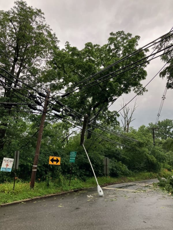
Two Tornados May Have Touched Down In NJ, Thousands Without Power
The National Weather Service is investigating two possible tornados during this weekend's storm in New Jersey.
UPDATE: Twister Bursts Massive Sports Dome In Ocean County, 2nd Tornado Confirmed In Burlington County
Preliminary surveys show twisters touched down near Cinnaminson and Delran, in Burlington County, and in Howell Township, in Monmouth County, during the storm Saturday, April 1, the NSW's Mount Holly office said.
Tornados in April 1 storm.National Weather Service
Surveys will be conducted Sunday, April 2.
Meanwhile, more than 1,000 residents were without power as of 8 a.m. S…